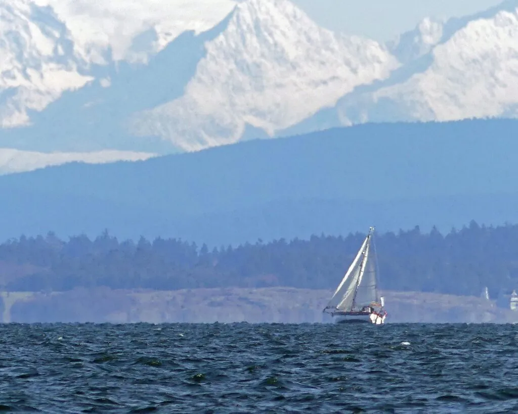
Bill had been sailing single handed aboard his Bristol Channel Cutter 28 Pixie for nearly 90 days from Christchurch, New Zealand to Victoria, British Columbia. It was the last leg of a year-long circumnavigation. Days of pristine ocean sailing were interspersed with alternating calms and gales. Prior to making landfall in New Zealand, Bill and Pixie had suffered a severe knock down while crossing the Indian Ocean. The mishap had caused severe flooding below decks. Repairs had been made, but on this last leg, the effects of salt-water intrusion seized the starter on Pixie’s auxiliary diesel, leaving Bill to rely on his transom-mounted water generator to charge his batteries. Although Pixie was equipped with a complete suite of electronics, including an AIS transceiver, approaching the coast of British Columbia Bill reported Pixie had very low batteries and, as a result, limited communications. Friends and family waiting ashore had only the YB Tracker, a satellite signaling device, to follow Pixie’s progress.
WHAT ARE FRIENDS FOR?
Because I’ve known Bill for a number of years and worked on Pixie prior to his departure, I thought he would appreciate an escort into his home port at the Royal Victoria Yacht Club, Cadboro Bay, near Victoria. The winds of the city waterfront can be fickle and, with Pixie’s engine out of commission, I thought it would be prudent to have a tow nearby when transiting the heavily used commercial traffic lanes.

To reach home, Bill would have to negotiate the length of Juan de Fuca Strait, a 60-mile stretch of water separating Washington State from Vancouver Island. Running eastward towards Victoria from the Pacific Ocean, the 15-mile-wide strait is notorious for strong westerly winds (good for Pixie!) and extended calms (not so good for Pixie). It also generated strong currents, with the eastern end experiencing up to 6 kn during large flood or ebb tides.
I departed our home port of Sidney aboard Natasha, our Islander Bahama 30, and made my way past Victoria to Sooke Harbour. This protected harbour is located near the east end of Juan de Fuca Strait, and I believed it to be the best place to await Pixie’s passing on her way to Victoria. Based on the last known position and progress report provided by the YB Tracker, I expected Pixie to sail by sometime the following day, if the winds remained steady from the west.
While waiting at the public wharf in Sooke, I encountered John & Marg Green aboard their Farrier 31 Tri Sauterelle. John and Marg were long-time friends of Bill and had had the same idea to escort Pixie in. We had never met before and hadn’t known each others’ intentions.
Through YB Tracker we learned that Pixie had been becalmed in heavy seas near the entrance to the Strait more than 70 nautical miles west. The marine forecast called for calm winds for the following three days. There was no point in powering out to Pixie’s position to assist with a tow as the reported sea state made towing too dangerous. Patience was in order.
WEAK BATTERIES
Three long days later, the westerly winds finally filled in. By that time the batteries aboard Pixie were completely depleted, and the water generator was not creating any amperage while stationary in the sloppy conditions. The only communication was through the YB Tracker, which broadcast Bill’s occasional status and position reports. John worked out a dead reckoning position based on Pixie’s anticipated rate of advance, calculating that she would be passing Sooke Harbour some time around 1800 hrs. that day. Natasha and Sauterelle sailed out of Sooke Harbour in the mid afternoon to ensure Pixie hadn’t picked up speed and arrived earlier than expected. Bill wasn’t aware that he had a welcoming two-boat flotilla.
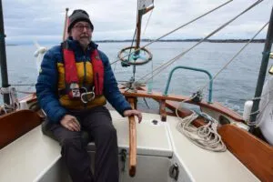
A few hours of patrolling in a 15-kn westerly on a beautiful sunny afternoon and, as hoped, Pixie appeared out of the distant haze flying twin poled-out headsails! We had found him! Bill had no idea that anyone had come this far into the strait to greet him and was overjoyed to see us! Late afternoon saw our three boats sailing east towards Race Rocks, the turning point towards the Victoria waterfront. The weather was glorious, there was a cool breeze over the stern, and the afternoon sun was keeping us warm. A spectacular crimson sunset over the stern slowly faded as darkness crept over the eastern horizon.
Race Rocks, a small island surrounded by dangerous reefs and marked by a historic lighthouse, is located about half a mile off the Vancouver Island shore, 10 miles from Victoria. It is here that Juan de Fuca Strait turns into a much wider body of water, the shoreline of Vancouver Island turns 90 degrees towards Victoria, with the Strait itself continuing on for another 40 miles towards the American San Juan Islands. Race Passage, a narrow funnel of water between the lighthouse and Vancouver Island shore, has the strongest, most turbulent tidal streams. The wider water of Juan de Fuca Strait on the outside of Race Rocks is not that much calmer.
As predicted, the current at Race Passage turned from a favorable afternoon flood to a four-knot ebb against us as we approached in the dark. We had a discussion whether or not to go outside of Race Rocks for more sea room and, hopefully, less oncoming current. There was no talk of retiring to Sooke Harbour, as the clear skies and easing winds were most benign. The prediction of fog banks after midnight seemed reasonable. We would be at our destination well before then. John and I had discussed towing options should the wind evaporate completely during the night. The earlier 15 kn westerly had already eased considerably, with only a light chop on the water. All three skippers had many years of sailing experience, both coastal and offshore, and the conditions seemed perfect for getting home.
Natasha was equipped with a chart plotter and AIS transceiver. John and Marg’s Sauterelle had a chart plotter, with a third-party AIS on a cell phone. Sauterelle did not appear on Natasha’s chart plotter as a target. Aboard Pixie, Bill had insufficient battery power to keep his instruments on; no chart plotter or AIS signal. He was hoping to keep his navigation lights operating during the night. This was communicated to us with one of his last VHF transmissions. Neither Natasha nor Sauterelle had radar. Pixie did, but no power to use it.
BUILDING WIND AGAINST AN EBBING TIDE
By 2000 hrs. the orange glow of a full moon slowly emerged out of the dark eastern horizon, with a canopy of stars overhead. Contrary to the forecast, the westerly winds had picked up and were hovering at 20 kn. The wind was most welcome, but it was up against a solid 3-kn ebbing current. To say the seas were boisterous would be an understatement! The wind against current was creating a maelstrom on the water. Aboard Natasha, running hard on a very broad reach, I was sailing at over 7 kn through the dark, whitecapped water, peaking at 9 kn down some of the larger waves. Still, Natasha was covering only 3 – 4 kn over the bottom! Yes…frustrating, but all was well, and the three boats were surging through the short, steep seas in the darkness, running lights clearly visible. We could see the bright lights of Victoria 10 miles to port and the beckoning lighthouse of our destination near the Royal Victoria Yacht Club in Cadboro Bay 13 miles ahead.
A compass course was determined and shared. We would be cutting diagonally across what could be described as a rectangular body of water, crossing both inbound and outbound deep-sea traffic lanes where vessels are controlled by the Canadian Coast Guard Marine Traffic Services. Although concerned about encountering freighters in the dark, I believed that our small cluster of boats, clearly identified with an AIS transmitter, wouldn’t pose much of a problem in this large body of water. John and I were unable to communicate with Bill aboard Pixie and were basically dedicated to following him. And he was aimed for home! Sauterelle was just ahead to starboard, Pixie further ahead and to starboard of Sauterelle. Three little boats in echelon.
And then the fog rolled in! I watched the lights of Race Rocks disappearing astern as fog suddenly approached from behind. I warned John by VHF, but there was no communication with Pixie, his navigation lights still visible nearby. Bill could be seen in the moonlight, removing his foresail poles, presumably to allow more flexibility in maneuvering under sail. The menacing fog quickly rolled in over the stern quarter, enveloping our trio. Everything disappeared! Aboard Natasha I could just see my navigation lights reflect off the fog, everything else was an all-encompassing black. I could feel the sudden drop in air temperature with condensation covering my glasses and the chart plotter. We were suddenly in a rapidly deteriorating situation!
The sails were slamming in the 20-kn gusts in the fog, with vicious quartering seas throwing I about. Then the outhaul on the mainsail failed! The loose footed main lost all shape against the mast and I heeled over ponderously under the pressure of the gusts. Releasing the main sheet and turning to port on a broad reach I was able to minimize the ballooning mainsail. I was hanging on to the wheel, trying to maintain a compass course as Natasha rocketed down the steep seas. A crackling VHF radio had John calling from the Sauterelle to say that he had lost sight of Pixie and, when trying to douse the foresail, the halyard had let go. The sail was under the boat! With little forward motion he was trying to get it back aboard. John and I were operating independently with no knowledge of where Pixie had gone. Fear of an imminent collision was my most pressing concern! This was one of the few times in my sailing life where I actually feared for my safety! I hauled the wheel further to port onto a beam reach, away from where I thought the other two boats should be, the mainsail slamming furiously against the mast. If anything else went wrong on deck I would be in serious trouble! How did I get myself into this suddenly cascading trouble? What were my options?!
A DETERIORATING SITUATION
From previous experience sailing these waters, I knew that the fog bank typically streamed by in Juan de Fuca Strait and would probably not turn the corner towards Victoria. I maintained course to port, toward the shore near the Victoria waterfront, seeking some protection from the strong wind and high seas while hoping to escape the fog bank. The fogged-over chart plotter showed the way through wet, blurred eyeglasses, salt spray flying back from the bow. I couldn’t really slow down, I needed boat speed to escape the current pushing me back towards the reefs of Race Rocks. After a very tense hour of racing through impenetrable fog as fast as Natasha could go with her scandalized mainsail, I suddenly sailed into clear conditions, the fog bank rolling eastward behind me. I could see the entire Victoria waterfront still 5 miles away, our destination lighthouse in the distance and slightly to starboard. I called John on Sauterelle and told him I was in the clear. John replied that he had fought the sail back on board and was sailing in fog, turning in my direction. No word from Pixie.
Taking stock of the situation I believed that Bill would steer Pixie on the last known compass heading towards the original destination, Cadboro Bay. Bill was a seasoned ocean sailor and I believed he would take prudent action. However, I knew he had no navigational aids and, potentially, no navigation lights. He certainly wasn’t answering his VHF radio! Pixie would be crossing the traffic lanes blind, depending on deep-sea vessels to locate him by radar. The AIS on my chart plotter showed traffic in both directions. Not a safe situation for Pixie!
The wind and seas had moderated in the clear air and I repaired the flopping mainsail, getting it back under control. I hove to and contacted Victoria Marine Traffic Services on VHF. The circumstances were described to the radio operator and I asked if Pixie could be identified on radar. I was looking for a lat/long position to head back into the fog, hoping that Traffic Services could guide me back to Pixie. That fix was provided, Pixie was about five miles away to starboard and appeared to be close to stationary. The operator reported multiple deep-sea vessels nearby that would be using the restricted sea lanes. The radio operator expressed concern about Pixie’s location and safety. I was asked to contact the Rescue Coordination Center by cell phone.
The operator at the Rescue Coordination Center was briefed on Pixie’s situation; out near Race Rocks, possibly in the traffic lanes, without any electrical or engine power, no working communications, and it was unknown if the navigation lights were still working. When asked about my intentions I said that I would be on my way back to Pixie’s location and, with Victoria Traffics’ assistance, locate and escort or tow Pixie to safety. After some discussion I was advised that the Rescue Coordination Center would be dispatching the rescue vessel Cape Calvert from Victoria Harbour to attend to Pixie, now identified as being in the center of the inbound traffic lane. I was (firmly) advised to continue to the original destination of Cadboro Bay and not become a secondary problem. Feeling somewhat slighted (I didn’t think that I was necessarily a “problem”), I recognized the situation from an outside perspective and started sailing towards the Yacht Club. That information was relayed to John aboard Sauterelle who radioed that he would also be heading to Cadboro Bay.
The Cape Calvert roared by out of the dark, steaming towards the fog bank, as I made my way towards the distant lighthouse. The wind had eased considerably with the seas much more manageable. In discussion with the Rescue Coordination Center, I learned that Pixie would be towed to the Canada Customs dock in Victoria Harbour, no thought of a tow to Cadboro Bay. John and I decided to alter course and sail to Victoria for the night. Bill would still have to reach the Royal Victoria Yacht Club the following day and a tow would probably be necessary. Natasha and Sauterelle arrived safely in Victoria Inner Harbour shortly after midnight.
COFFEE HELPS
The next morning dawned clear and bright as the trio of skippers reunited at the Customs Dock. While enjoying his first coffee in a month, Bill regaled us with the tale of reducing sail and retiring below decks, only to be deafened by a ship’s horn and dazzling white light as the Cape Calvert loomed out of the fog. At his invitation, a crew member climbed aboard and helped secure a towline for the 10 miles to Victoria Harbour, arriving safely before 0200 hrs.

Canada Customs officials arrived at the dock and welcomed Bill back into the country, no need for a 14-day Covid 19 isolation period! With Sauterelle as escort, I was soon towing Pixie around the Victoria waterfront. The skies were sunny and the water flat as we made our way to the Royal Victoria Yacht Club. What a difference a day makes! A bit of an anticlimax for a year-long solo circumnavigation, but Bill couldn’t have been more pleased.
LESSONS LEARNED
Hindsight is always 20/20. But what could I have done differently to avoid putting ourselves and rescue services at risk? This was not a planned event, and perhaps it should have been. I was simply sailing out to greet a fellow sailor on the last leg of a solo circumnavigation. I met John and Marg for the first time in Sooke Harbour. They had the same idea. Having sailed these waters before, I could have been better prepared. John and I should have developed a “worst case” or “what if” plan and somehow relayed that to Bill aboard I, by hand or throw bag, during the remaining daylight. With that we could all have turned towards the Victoria waterfront with the arrival of the fog, sailing out of danger. The real difficulty was the inability to communicate with Bill, compounded by the unexpected adverse conditions.
With the fog predictions available at the time, should we have stopped at Sooke Harbour and waited for better conditions? In hindsight, that may have been prudent. But we expected to be in port long before the fog was expected to arrive. At the time we intercepted Pixie and were approaching Race Rocks the sailing conditions were fabulous, no reason to take any other action. It would also have been problematic in that Pixie had not yet cleared Canada Customs, and in these pandemic times the rules were being fully enforced. The tow by the Cape Calvert was to the Customs Dock, and nowhere else!
During envelopment in fog should I have taken different action? Yes. I should have contacted Victoria Traffic Services or the Canadian Coast Guard immediately to appraise them of the deteriorating situation with Pixie. I may have been able to stay with Bill under radar guidance. But I was also struggling with my own safety and that avenue just never occurred to me at the time.
Essentially, I wasn’t well enough prepared for the conditions we encountered/should have expected. A bit of trouble and a brush with difficulty is always a useful reminder of the dangers of the sea.
See our accompanying review of Bill’s Bristol Channel Cutter Pixie. It takes a remarkable boat, and a remarkable person, to girdle the globe.
