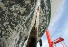
I often worry that the topic of chart accuracy, which we revisit in this issue, obscures the importance of other skills, published sources, and equipment we should use to solve a navigational puzzle. A recent bottom-bumping cruise along the changing coast of Southwest Florida reiterated some key points regarding coastal navigation.

1. At the very minimum, a small-scale planning chart for the area you are sailing should be part of your portfolio. As reader Bill Wieg points out in this months Mailport section, zooming out to planning scale on a vector chart often results in key obstructions disappearing from view, making it too easy to lay a course that intersects with known hazards.
2. Coast Pilots and a good cruising guide can save a lot of headaches, especially when making final approaches to gunkholes that neither printed nor digital charts have accurately portrayed. Two inlets we used during our short cruise were clearly mischarted, as shifting sands had not only shifted the channel position, but also made the fixed navigational aids misleading.
3. Seek out reliable local knowledge. Local professionals, the U.S. Coast Guard, and online resources like Active Captain can be an important source of information when navigating areas that are known for shifting shoals. In most popular ports, tow-boat operators and local marina operators are standing by to help guide sailors around known dangers that are not on charts.
4. Use your senses. As much as possible, the navigator should try to time challenging navigation when natural forces are in working in his or her favor. A rising tide, good visibility, relatively calm water, and plenty of sunlight at your back can turn a tricky cut into Easy Street. Favoring windward sides of poorly marked, shallow channels means that if you do go aground, there is less risk that youll be driven further into shoal water, and it will be easier to extricate yourself.
5. Dial in your electronics. Depth and radar alarms can be an extremely useful asset in scenarios where the bottom contours are prone to shifting, or where some features are poorly charted. They can be even more helpful if youve optimized the settings. For example, a deeper than normal alarm setting can alert you sooner when you are creeping toward the shallow side of a channel with sloping sides.
6. Approach with caution. Fortunately, much of the seabottom is sand or mud and most cruising boats can take a soft-grounding without harm. So long as you use a slow speed, backing or kedging off can be a simple operation.
7. Have an exit strategy or alternative anchorage. As you approach, discuss with your crew exactly what you will all do if you touch bottom, if you feel uncertain about what you are seeing, or are forced to change your landfall due to weather conditions.
In the debate over paper versus digital charts, it is easy to forget that the most important navigational element on board is neither your chart or your plotter, but the captain and crew. Making sound decisions requires having good information, and as the navigators rule asserts, you should never rely solely on a single source for that information.


