While we’re in the middle of lining up a series of tests of electronic navigation devices and systems, I’m reminded how easily these devices can leave novice navigators unprepared for the real-world problems that they will face during a long coastal cruise or ocean crossing.
While we are truly entering the golden age of mapping the earth’s surface, chart accuracy remains a problem as you venture off the beaten track. As Ralph Naranjo reported in his outstanding report in the April 2016 issue of Practical Sailor, today’s navigators still require a range of traditional skills, published sources, and equipment to solve a navigational puzzle. A bottom-scraping cruise I took along the ever-changing coast of Southwest Florida reiterated some key points regarding coastal navigation.
1. Carefully plan your route ahead of time. Plug in your waypoint “bread crumbs” well in advance, not the night before you leave. Whether you are using coordinates or the map cursor to place them, double check their positions, using an appropriately scaled and up-to date chart (see #2 below). Make sure the routes connecting two waypoints lead safely clear of reefs or other hazards, and allow plenty of room for any chart inaccuracies. In addition to the navigator, I like to have at least one other crew-member check the waypoints. It not only puts another set of eyes on this vital information, it familiarizes them with the route should the navigator be unable to perform their duties. These waypoints, of course, should not be considered etched in stone. Currents, wind will effect your actual course, requiring route changes, and you may discover the route you plotted from the comfort of your marina slip did not take into account a new wreck, or a bridge under construction at your destination.
2. Don’t knock printed charts. Printed charts have much to offer, especially when planning routes, or making significant routing changes. At the very minimum, a printed small-scale planning chart for the area you are sailing should supplement your digital portfolio. As anyone with a chart-plotter knows, zooming out to planning scale on a vector chart often results in key obstructions disappearing from view, making it too easy to lay a course that intersects with known hazards. This is exactly the type of oversight that led to the grounding of Vestas Wind. Detailed, large scale printed charts of your destination, and of key “emergency” ports along your route can greatly reduce stress when Murphy’s Law takes hold. If the navigators at the highest level of ocean racing can make routing mistakes, we can, too.
3. Use multiple reference guides. U.S. Coast Pilots, their foreign equivalents, and updated cruising guides can save a lot of headaches, especially when making final approaches to gunk holes that neither printed nor digital charts have portrayed accurately. Two inlets we used during our short cruise were clearly mischarted, as shifting sands had not only reoriented the charted channel position, but also made the fixed navigational aids misleading.
4. Seek out reliable local knowledge. Local professionals, the U.S. Coast Guard, and online resources like Active Captain can be an important source of information when navigating areas that are known for shifting shoals. In most popular ports, tow boat operators and local marina operators are standing by on VHF to help guide sailors around known dangers that are not on charts, but even these sources should be cross-checked whenever possible. Ideally, your sources should be knowledgeable owners of boats with a similar draft to your own.
5. Use your senses. As much as possible, the navigator should try to time challenging navigation when natural forces are in working in his or her favor. A rising tide, good visibility, relatively calm water, and plenty of sunlight at your back can turn a tricky cut into Easy Street. Favoring the windward sides of narrow, shallow channels means that if you do go aground, there is less risk that you’ll be driven further into shoal water, and it will be easier to extricate yourself.
6. Dial in your electronics. Depth and radar alarms can be an extremely useful asset in scenarios where the bottom contours are prone to shifting, or where some features are poorly charted. They can be even more helpful if you’ve optimized the settings. For example, a deeper than normal sonar alarm setting can alert you sooner when you are creeping toward the shallow side of a channel with sloping sides. Properly adjusted, todays hi-definition radar can pick up fish traps as well as channel markers.
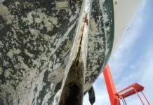
7. Approach with caution. Fortunately, much of the sea bottom in popular cruising areas are sand or mud, and most cruising boats can take an Intracoastal Waterway soft-grounding without harm. So long as you use a slow speed, backing or kedging off can be a simple operation. Of course, the stakes are much higher in many places, making a cautious approach even more advisable. Not allowing plenty of sea room between the boat and poorly charted reefs has caused the unfortunate end to many cruising dreams (see my related post on the wreck of a 46-foot catamaran in French Polynesia in 2017).
8. Have an exit strategy or alternative anchorage. Don’t be so rigidly fixed to your cruising plans as to put your boat and crew at risk. Try to anticipate any challenges an upcoming obstacle might present and discuss in advance with your crew what will be expected if you suddenly find that seven-foot channel depth is reading five feet on your sounder.
In the debate over paper versus digital charts, it is easy to forget that the most important navigational element on board is neither your chart or your plotter, but the captain and crew. Making sound decisions requires having good information, and as the navigators rule asserts, you should never rely solely on a single source for that information.












A few decades ago, when my daughter was small, we enjoyed multiple cruises along the east coast off Virginia and Maryland, and up the Virginia Inside Passage. Although it looks like an extension of the Intercoastal Waterway, it tends to be shallow, entrances shift (some are not even charted they shift so often), and dredging is non-existent. Paper charts are vital, the Coast Pilot helps with changes that have not been published, and Google Earth can be be a vital aid.
And we did it without electronic aids. We had GPS, but since the channel isn’t where the electronic charts think it is, you are better off watching fisherman-place poles, the color of the water, the shape of the shoreline (which gives hints about shoal locations), and the chart plotter. Thankfully, the bottom of the passage is mud. But the entrances are a different matter. Sand is hard, so don’t try these in on-shore conditions and wacht the shape of the waves (nearly impossible to judge from seaward), and be prepared to bail and go to the next entrance.
Don’t bury your head in the cockpit. You need to look at the water.
9. All of the above plus make use of the masses of very useful info available online. Like downloading satellite images as an addition to charts where nautical charts are unreliable or don’t exist. Search on youtube How to Download FREE Satellite Images in 2020 – Ep 113 Sailing Luckyfish.
Sasplanet can also be a great way not just to get data from multiple sources (usually one of the sat image sources will be at low water) but also check if the datum of you charts is accurate, opencpn does split screenso you can have satellite . And in addition to 3, online crowd sourcing nav sites like navily & noforeignland will often have much more recent info about harbours etc than commercial or official guides.
Anything and everything with a pinch of salt
PS, the Vestas ground, istr, could have been avoided if they had not ignored their own written down checksheets which included checking the intended route on google satellite zoomed in to make sure it was clear, plus have a downloaded copy of zoomed in google satellite images onboard for checking along the way. If either of these hadn’t been ignored it’s very likely they would have been fine.
Enroute from Vanuatu to Bundaberg, Australia October 17, 2000, mid-afternoon, we had a closer than comfortable encounter with Bampton Reef. I had decided to cut in reasonably close to the reef to minimize route distance. In other words, cut the corner. I plotted a waypoint at 19.06S/158.15E which avoided the northeastern edge of the reef by about five miles. As we neared the waypoint, we could see a reef backed by a lagoon on the bow less than a mile away! Indeed, if we had not altered heading, we would have run up on it. I had planned this as a daylight segment of the passage, but what if we had arrived at night? Disturbing! I had failed to consider a possible disparity between chart plotter data and reality. Lesson: corner cutting can be hazardous!
Read the complete article at https://www.yachtsandyachting.com/news/210924/On-to-Australia
Great reminders. Thx for posting.
IMO paper vs. electronic is a red herring. At least for the US, NOAA updates the electronic charts first (or at the same time for any critical updates). The problem is when people assume that navigational skills are no longer required, or when apps are put forward that lack basic functionality critical to safe navigation. I would hesitate to describe such skills and methods as “traditional” when in my mind they are still applicable and necessary in the electronic realm.
Good navigation requires a number of elements, including:
1- Reviewing the route for hazards. It’s poor practice to use only small-scale paper charts to check for hazards as part of pre-planning, so why would suddenly it become OK to do the equivalent with electronic (i.e. being zoomed out)?
2- Not relying solely on GPS to fix position. As “the prudent mariner will not rely solely on any single aid to navigation”, why are people tolerating software that relies solely on GPS for positioning? Recreational apps that don’t allow you to plot a visual or radar fix are, IMO, inadequate for primary navigation. It’s akin to taking a paper chart but leaving behind compass and plotting tools.
3- Keeping charts up to date. NOAA pushes updates about every Thursday and I can pull them down at the press of a button. How many people are so diligent with their purple chart correcting pens? An SD card of indeterminate age in a plotter is little different from a stack of yellowed paper in this regard.
4- Awareness of, and accounting for, chart accuracy. Just as paper charts contain information about when and how different areas were surveyed, so too do electronic charts. Do users now how to access this information? Which apps even permit it?