Handheld GPS
I have the greatest respect for the equipment reviews in Practical Sailor, but I think that you overlooked very critical attributes for your April 1 article, Value Guide: Handheld GPS, particularly in your evaluation of the Magellan NAV 6000. I just conducted a thorough personal evaluation of this as well as the comparable Garmin units while considering them primarily as cartographic devices, and I found the NAV 6000 far superior. I am the first to admit that the built-in map database of the NAV 6000 is virtually useless for its lack of detail, but I do not think that the Garmins is really much better; if you are so ignorant of even your approximate location that you find the information on the better Garmins built-in database useful, you really shouldnt be out on the water at all. I believe that both units are really meant to be used with their respective cartridges to display critical details, and taking this into consideration the NAV 6000 is far superior for marine navigation.
Consider the content of the Garmin cartridges. Their proprietary content is based on Navionics data but, unfortunately, Garmin does not retain the depth information and other important details found in Navionics cartridges. In an earlier article, you clearly showed that the Garmins display of coastlines (using an island as an example) was, at best, something that I would describe as a childs crayon drawing because of its lack of realism. In contrast, the NAV 6000 uses actual C-Map NT cartridges, and can display coastlines realistically as well as provide almost all the information (including depths) contained within these state-of-the-art cartridges, minor exceptions being the tide-table and some port service information.
Who would buy a paper chart that lacks depth soundings or contours? So why choose a cartographic GPS that cannot show these same features? Considering these units in light of their cartridges contents, the way they are designed to be used (and I believe will be used by most purchasers), the above analogy to paper charts makes the NAV 6000 the better choice.
Ken Crossner
Somerset, New Jersey
Normally I respect your opinion on boat gear, but I can’t figure out why you are so down on the Magellan NAV 6000. I compared it to the Garmin 175 when I made my purchase and I consider it to be superior to the Garmin for these reasons:
1. The screen sizes are similar but the Magellan has many more pixels (better for reading in a moving boat).
2. The G-charts for Lake Michigan that I examined did not have nearly the detail on them that the C-Map charts did. C-Map charts are used by more companies and I have long ago learned that OEM products are a much better way to go so that you don’t get locked in to one out-of-date supplier with high prices. Most sailors assume that charts will have to be continually up-dated for safe passage-making and C-Map charts are better to begin with.
3. Ergonomics. Try holding a GPS in either hand then reach over with the other hand and press the rocker switch. On the Magellan your wrist doesn’t block the viewing screen because it is placed above the button area as you leave your finger there to press another button to execute another function.
4. Personally, I would rather have to open a special compartment to replace a cartridge than take the chance of losing a cartridge overboard by accidentally bumping the unit on a seat or railing. Cartridges are expensive. Magellan, in my opinion, has a better thought-out design in this respect.
Im not just trying to justify my purchase of Magellan over Garmin. These are important considerations if you are a serious sailor.
James F. Todd
Ada, Michigan
Recently, Ive been considering buying a handheld chartplotter so I was interested to read your review of the Garmin 175 and the Magellan NAV 6000 in the April 1 issue. In a publication whose selling point is informed and unbiased product evaluation, I was dismayed with what I read.
You fault the 6000 because of its lack of a detailed base map. Who cares? You don’t buy a $600 chartplotter to navigate with the base map! You also fault its ergonomic design. Both of these units are too big for single-handed operation (I tried them). Ill bet 95% of these units are used with a mount attached to a pedestal or cabin bulkhead, making ergonomics a non-issue. Finally, you say its unacceptable that you have to open the battery compartment to change the cartridge. As if youd be changing cartridges frequently! As you stated for the 175, most people will never need more than one or two cartridges. Probably only one.
However, the problem isn’t just your misleading and uninformed comments. Its what you don’t talk about thats really surprising. The Magellan costs an extra $100. Do you get anything for that? The 6000 has higher resolution than the 175, with twice the pixels. On a small screen, that might be good. Since no one (with a brain) is going to use either of them without a cartridge, how do these compare? A salesman at Hamilton Marine in Searsport, which sells both units, told me the following. The C-Map NT cartridges cost $199, cover a smaller area than the Navionics, and will zoom to 1/10 mile in all areas of the chart. The Navionics cartridges cost $299, cover a greater area than the C-Map and will zoom to 1/8 mile in some but not all areas.
Is this true? Im not sure, but its the kind of information your review should include.
I suspect both of these units are excellent. To not recommend one for reasons no one cares about is insulting to your readers.
Bruce Olson
Waterville, Maine
I am a sailor and a private pilot. I have used Garmin, Magellan, Raytheon, and Lowrance products for years. I am currently using panel-mounted Morrow equipment in the aircraft, with Apollo moving map display and VHF nav com built in, as well as an old Garmin 100 with data base. On the boat, a Gulfstar 47, I have the Raytheon chartplotter, with C-Maps, linked to Loran and GPS, and also displayed on the radar.
But, my favorite piece of equipment, and one that travels with me everywhere, is the Lowrance 100. It has excellent versatility. Its map display is quite good. It is the only GPS which has both an aviation data base (Jeppesen) and marine data base. I load current aviation data through a floppy disc. Then, when getting on the boat, I download the database from a CD Rom-the IMS Mapcreate system with all the nav aids, plus the area land data for the area in which I am sailing. All buoys are named and numbered. The accuracy is fantastic. The unit can be positioned on the yoke of an aircraft or the instrument cluster on a sailboat.
I prefer the Lowrance as my primary navigational aid. Its the best thing on the market. Garmin is good, but the use of the cartridges, as distinguished from CD Rom and floppy discs, make it an antediluvian machine.
John H. Haley
Little Rock, Arkansas
We did our best to get a Lowrance for the evaluation, but as reported, the 100 was in the process of being unbundled and not available.
Bilge Pump Modification

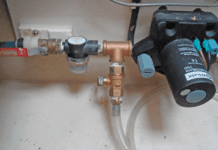
I always assume that bilge pumping will be done in the middle of the night with the boat being tossed around by big waves. I also assume that debris will be sucked up and clog the flapper valves (even with a strainer on the pick-up end).
Ive modified my Whale Titan so that it can be taken apart quickly, without tools and without dropping nuts and bolts.
Steven Peterman
Inglewood, California
Sunscreens All The Same
Regarding last years article on sunscreen, excessive exposure to sun and repeated sunburns (blistering) definitely causes skin cancer. The incidence of melanoma (black skin cancer) is 16 times as high in the southern states as it is in the northern states. It is also 16 times as high amongst white skinned Australians as opposed to northern Europeans. Basal cell cancers (chronic ulcers) are also more common in farmers and the older sailors, as are the more lethal squamous cell cancers.
Your photograph of a woman applying sunscreen is also misleading. Not only should the person be out of the sun, but they should also be inside, cool and dry, before applying the lotion. The lotion must be allowed to dry well before going outside (wait 30 minutes). I work as a part-time windsurfing instructor and spend 8 to 10 hours a day in the sun and water in Texas. I never towel off and at the end of the day I need to spend 10-15 minutes in a shower with a lot of soap to get the lotion off.
I use generic waterproof brands from Walgreens or Eckerds at 74/oz. In my opinion, all the fancy brand names with additives have no advantage for sun protection but certainly add to the profit margin of the manufacturer. I use SPF25 on a bald head, 15 on my face, 8 for the body and SPF4 for the legs and never get burnt. Eventually and slowly one gets a controlled browning. Even redheads and people with very light skin can get brown if they use SPF25 over the entire body-and take several weeks. Anything stronger than SPF25 is unnecessary, adds no benefit, and is an unnecessary expense.
I.R. Munro, MD
via email
You missed the best sunscreen Ive ever tried. Westwood-Squibb Pharmaceuticals, Inc. makes PreSun brand sunscreen in an Active Clear Gel with a 30 SPF. I have very fair skin and have used this with great success both sailing in the Caribbean and taking road trips in my Miata. One good application every three to four hours keeps me sunburn-free, and the gel even feels good (nice and cool) going on-its not greasy at all.
The only downside is that its sometimes hard to find, but the Sun Precautions catalog sells 30 SPF clothing that also is great for sailing (www.sunprecautions.com) as well as PreSun Ultra Clear Gel via mail order. See also www.westwood-squibb.com/products/presun/presun.htm.
Monica Gerhardstein
Decatur, Georgia


